Spatial Navigation: How Your Brain Finds Its Way
- Core Definition of Navigation
- Historical Evolution of Navigation
- Biological Navigation in the Animal Kingdom
- Key Components of the Navigational Process
- The Role of Technology in Modern Navigation
- Practical Applications Across Various Domains
- Significance and Broader Impact on Society
- Connections to Other Psychological Concepts
Core Definition of Navigation
Navigation is a fundamental and multifaceted process by which humans and animals orient themselves within their environment and plan, execute, and monitor movements from one location to another. At its most basic, it is the ability to find a path to a desired destination without getting lost, a skill that has been absolutely essential for survival and societal development throughout history. This complex cognitive and behavioral function involves the intricate integration of sensory information, memory, and decision-making processes, enabling individuals to understand their current position relative to their surroundings and to plot an efficient course towards a goal. It encompasses everything from a simple walk to a familiar store to a complex interstellar journey, always relying on an internal representation of space and the external cues available.
The fundamental mechanism behind navigation involves the construction and utilization of an internal representation of the external world, often referred to as a cognitive map. This mental model of space allows an individual to visualize routes, estimate distances, and identify landmarks, even in unfamiliar territory or when direct sensory input is limited. Beyond this internal framework, navigation also heavily relies on the interpretation and application of various external aids. These aids can range from natural indicators like the position of the sun, moon, and stars, or geological landmarks, to sophisticated technological tools such as physical maps, magnetic compasses, and modern Global Positioning System (GPS) devices. The interplay between internal cognitive processes and external navigational cues forms the bedrock of successful wayfinding, allowing for adaptive behavior in diverse and dynamic environments.
Historical Evolution of Navigation
The ability to navigate is deeply ingrained in human evolution, predating recorded history and serving as a critical factor in the dispersal and survival of our species. Early humans, like their hominid ancestors, relied primarily on their innate spatial awareness and keen observation skills to traverse their surroundings. They utilized prominent natural landmarks, such as mountains, rivers, and unique tree formations, as reference points to establish their position and direction. Furthermore, the regular patterns of celestial bodies, particularly the sun during the day and prominent stars and constellations at night, served as indispensable guides for long-distance travel and seasonal migrations, allowing for purposeful movement across vast, often featureless, landscapes.
As human societies developed, so too did their navigational sophistication. By the Bronze Age, advancements in observation and record-keeping led to the creation of rudimentary maps, initially simple sketches on clay tablets or animal skins, which depicted local territories and established routes. The invention of the magnetic compass, believed to have originated in China around the 11th century, marked a pivotal moment, providing a reliable means of determining direction independent of celestial visibility. These innovations were not merely academic exercises; they were instrumental in facilitating monumental historical endeavors such as large-scale exploration, the establishment of intricate trade routes that connected distant civilizations, and the strategic planning of warfare, fundamentally shaping human geography and cultural exchange.
The Age of Exploration, beginning in the 15th century, witnessed further leaps in navigational technology and methodology, driven by the desire to cross oceans and discover new lands. Instruments like the astrolabe and quadrant allowed sailors to determine latitude by observing celestial bodies, while the development of accurate chronometers in the 18th century finally enabled precise longitude calculation. In the modern era, the trajectory of navigation has shifted dramatically towards reliance on advanced technology. The advent of satellite-based systems, most notably the Global Positioning System (GPS), has revolutionized wayfinding, transforming it from a specialized skill into an accessible utility for billions worldwide, marking a profound paradigm shift in how individuals and industries interact with and traverse their environment.
Biological Navigation in the Animal Kingdom
Navigation is not exclusively a human trait; it plays an equally vital and often astonishing role in the lives of countless species across the animal kingdom. The remarkable navigational feats of animals, from the seasonal migrations of birds covering thousands of miles to the precise homing abilities of pigeons, underscore the deep evolutionary significance of this skill for survival, reproduction, and resource acquisition. Animals employ an incredible array of sensory inputs and internal mechanisms to orient themselves and find their way, often exhibiting abilities that far surpass human capabilities without technological aids.
Many animals possess highly specialized internal biological compasses that enable them to sense and respond to environmental cues imperceptible to humans. For instance, migratory birds and sea turtles are renowned for their ability to navigate using the Earth’s magnetic field, a phenomenon known as magnetoreception. These creatures have evolved biological sensors that allow them to detect the inclination and intensity of magnetic lines, providing them with a reliable, global coordinate system for their epic journeys. Other internal cues include an innate sense of time (circadian clock) which allows them to compensate for the sun’s movement, and olfactory maps, where animals like salmon use distinct chemical signatures in water to return to their natal streams.
Beyond these intrinsic biological compasses, animals also masterfully utilize a variety of external navigational cues. Birds, insects like honeybees, and certain fish species rely on the position of the sun and the patterns of polarized light in the sky to maintain a constant bearing. Nocturnal animals often navigate by the stars, recognizing constellations or the overall pattern of the night sky. In terrestrial environments, animals frequently use visual landmarks, much like humans do, committing routes and significant features to memory. Chemical trails, such as those laid by ants, provide a robust system for colony members to follow established paths to food sources and back to the nest, demonstrating the diverse and sophisticated strategies animals employ to conquer the challenges of spatial movement.
Key Components of the Navigational Process
The act of navigation is not a monolithic process but rather a complex interplay of several distinct yet interconnected components. Psychologists and cognitive scientists generally identify three primary pillars that underpin effective wayfinding: **orientation**, **dead reckoning**, and **route planning**. Each of these components contributes uniquely to an individual’s ability to understand their position, track their movement, and formulate a strategy for reaching a desired destination, whether consciously or unconsciously.
**Orientation** serves as the foundational step in any navigational endeavor. It involves the critical task of determining one’s current position and heading relative to a known reference point or a broader frame of reference. This process relies heavily on sensory input, such as visual cues from landmarks, auditory information from distant sounds, and proprioceptive feedback from one’s own body movements. For instance, knowing that a prominent building is to your north allows you to orient yourself within a city grid. Orientation can operate within different reference frames: an **egocentric** frame where one’s position is relative to their own body (e.g., “the store is to my left”), or an **allocentric** frame where positions are relative to external objects or a global coordinate system (e.g., “the store is north of the park”). The accuracy of initial orientation significantly impacts the success of subsequent navigational steps.
**Dead reckoning**, also known as path integration, is the process of continuously estimating one’s current position by tracking a series of movements from a known starting point, without relying on external reference points after the initial setup. This method involves mentally integrating information about the distance traveled and the direction taken over time. For humans, this relies on internal cues such as the vestibular system (sense of balance and head movement) and proprioception (awareness of body position and movement). If you close your eyes and walk in a complex pattern, your brain uses dead reckoning to maintain a rough idea of your current location relative to your starting point. While incredibly useful, dead reckoning is prone to cumulative errors; small inaccuracies in estimating distance or direction can compound over time, leading to significant deviations from the actual path, especially over long distances or in environments lacking strong external cues.
Finally, **route planning** is the cognitive process of creating a course of action or a sequence of steps to travel from the current location to a desired destination. This component leverages both the initial orientation and, potentially, past experiences from dead reckoning, alongside existing cognitive maps or external navigational aids like physical maps or GPS. Effective route planning involves several sub-processes, including identifying the destination, considering potential obstacles or alternative paths, estimating travel time, and selecting the most efficient or safest route. It requires problem-solving skills, decision-making, and the ability to mentally simulate movement through space. For example, when planning a road trip, one considers distances, road conditions, rest stops, and fuel availability, all integrated into a coherent travel plan.
The Role of Technology in Modern Navigation
In recent decades, the landscape of navigation has been fundamentally transformed by rapid advancements in technology, transitioning from reliance on manual calculations and celestial observations to highly automated, satellite-based systems. This technological revolution has not only made navigation significantly easier and more accessible but has also dramatically increased its precision and reliability, permeating nearly every aspect of modern life, from personal travel to global logistics and scientific exploration.
The most ubiquitous and impactful of these technologies is the Global Positioning System (GPS). Developed by the U.S. government for military use and made available for civilian applications in the 1980s, GPS operates through a constellation of Earth-orbiting satellites that transmit precise timing and orbital data. A GPS receiver on Earth triangulates signals from at least four satellites to calculate its exact latitude, longitude, and altitude with remarkable accuracy, typically within a few meters. This instantaneous and continuous positioning capability has revolutionized personal travel, providing turn-by-turn directions in cars, on smartphones, and wearable devices, making it nearly impossible to get lost in unfamiliar urban or rural environments.
Beyond GPS, a suite of other advanced technologies contributes to the sophisticated navigational capabilities we see today. **Geographic Information Systems (GIS)** integrate spatial data from various sources (maps, satellite imagery, demographics) to create comprehensive digital representations of the Earth’s surface, enabling complex spatial analysis and planning. **Inertial Navigation Systems (INS)** use accelerometers and gyroscopes to track position and orientation relative to a known starting point, particularly crucial in environments where GPS signals might be unavailable or unreliable, such as underwater or in deep space. Furthermore, technologies like **Lidar** (Light Detection and Ranging) and **Sonar** (Sound Navigation and Ranging) provide highly detailed topographical and bathymetric data, essential for applications ranging from autonomous vehicles to marine charting and geological surveying. These technologies collectively underscore the profound shift towards data-driven and automated navigation, enhancing safety, efficiency, and precision across diverse applications.
Practical Applications Across Various Domains
The principles and technologies of navigation are not confined to theoretical discussions but are deeply embedded in the practical fabric of modern society, underpinning a vast array of critical operations and daily activities. Its applications span from ensuring the safe passage of commercial aircraft to optimizing delivery routes for logistics companies, demonstrating its indispensable role in facilitating efficient movement and interaction across the globe.
In the realm of **transportation and aviation**, navigation is paramount. Pilots rely on sophisticated flight management systems that integrate GPS, inertial navigation units, and ground-based radio beacons to precisely determine an aircraft’s position, plot its route, and monitor its progress in three-dimensional space. This ensures adherence to air traffic control directives, efficient fuel consumption, and, critically, the avoidance of hazards such as adverse weather or other air traffic. Similarly, in **maritime navigation**, ships utilize electronic charting systems, radar, sonar, and GPS to plot courses, detect underwater obstacles, avoid collisions, and adhere to shipping lanes, safeguarding both cargo and human lives across vast oceans. The precision afforded by modern navigation systems has dramatically reduced accidents and improved the efficiency of global supply chains.
Beyond these traditional domains, navigation has found extensive application in everyday life and emerging technologies. **Automotive navigation systems**, once a luxury, are now standard features in vehicles and ubiquitous on smartphones, providing real-time traffic updates, optimal route suggestions, and turn-by-turn directions, transforming personal travel. This technology is also foundational for the development of **autonomous vehicles**, enabling self-driving cars to accurately perceive their environment, localize themselves on maps, and plan safe paths. Furthermore, navigation is crucial in **emergency services**, guiding first responders to incident locations rapidly; in **logistics and delivery services**, optimizing routes for efficiency; in **agriculture**, for precision farming; and even in **space exploration**, where spacecraft rely on incredibly precise navigation to reach distant planets and execute complex maneuvers. The ubiquity and sophistication of these navigational applications highlight its integral role in enabling and enhancing almost every aspect of contemporary human endeavor.
Significance and Broader Impact on Society
The significance of navigation extends far beyond merely getting from point A to point B; it is a fundamental human skill with profound historical, economic, and psychological implications, deeply shaping the trajectory of human civilization. Historically, the mastery of navigation was synonymous with exploration, discovery, and expansion, enabling ancient civilizations to engage in trade, establish empires, and populate new territories. Without the ability to reliably traverse land and sea, humanity’s understanding of the world would remain confined to local areas, severely limiting cultural exchange, scientific advancement, and economic growth.
In contemporary society, efficient and accurate navigation is a cornerstone of global connectivity and economic prosperity. It underpins the entire global supply chain, ensuring that goods can be transported efficiently and reliably across continents and oceans. It is essential for international trade, military operations, and humanitarian aid efforts, allowing for the timely deployment of resources and personnel. The continuous advancements in navigational technology have led to increased safety in travel, reduced travel times, and optimized resource utilization, translating into significant economic benefits and enhanced quality of life for billions of people worldwide. The ability to navigate reliably is, in essence, a prerequisite for the functioning of our interconnected modern world.
From a psychological perspective, the study of navigation illuminates critical aspects of human cognition and behavior. It provides insights into how the brain processes spatial information, forms cognitive maps, and makes decisions under uncertainty. The increasing reliance on automated navigational tools like GPS also raises important questions about the impact on our innate navigational skills and spatial awareness. While technology offers unparalleled convenience, there are ongoing discussions about whether it might lead to a degradation of natural wayfinding abilities, potentially affecting our spatial memory and our engagement with the physical environment. Understanding navigation thus offers a unique lens through which to examine the intricate relationship between human cognition, technology, and our interaction with the surrounding world.
Connections to Other Psychological Concepts
The study of navigation is inherently interdisciplinary, drawing heavily from various subfields within psychology and neuroscience, and serving as a crucial point of connection for numerous key psychological concepts. It is not an isolated phenomenon but rather an integrated process that involves perception, memory, learning, and decision-making, placing it firmly within the broader framework of cognitive science.
Within **Cognitive Psychology**, navigation is intimately linked to the study of **spatial cognition**, which examines how individuals acquire, process, store, and use information about their environment. This includes research into how we form and utilize cognitive maps – mental representations of our surroundings – and how these maps influence our route selection and wayfinding strategies. Concepts like **working memory** are vital for holding navigational instructions in mind, while **long-term memory** is essential for recalling familiar routes and landmarks. Furthermore, navigation involves complex **problem-solving** and **decision-making** processes, especially when encountering unexpected obstacles or needing to choose between multiple paths.
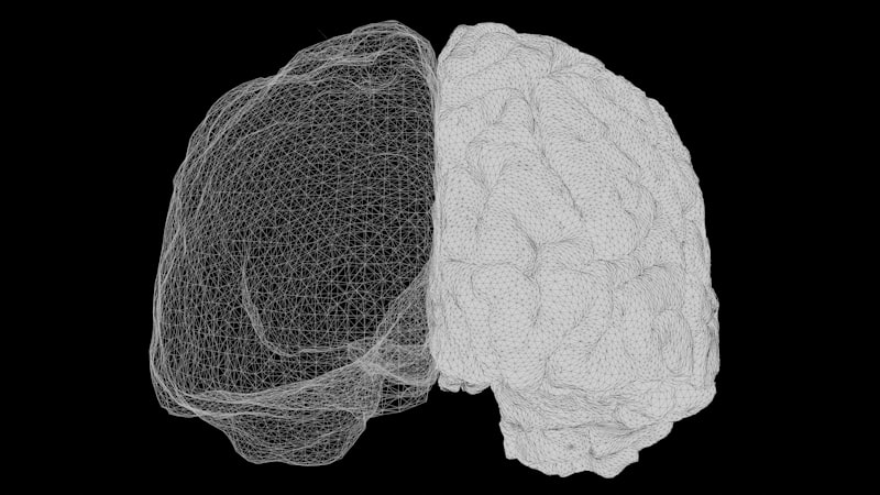
From a **Neuroscience** perspective, navigation has been a particularly fertile ground for understanding the brain’s spatial processing systems. Landmark discoveries, such as the identification of **place cells** in the hippocampus (which fire when an animal is in a specific location) and **grid cells** in the entorhinal cortex (which fire in a hexagonal pattern as an animal traverses an environment, providing a metric for space), have revolutionized our understanding of how the brain creates and maintains a spatial map. The **hippocampus** is recognized as a central hub for spatial memory and navigation, integrating various sensory inputs to construct a coherent representation of space. These neural mechanisms underpin our ability to orient, perform dead reckoning, and plan routes effectively.
Navigation also intersects with **Environmental Psychology**, which explores the interplay between individuals and their physical surroundings. This field examines how environmental design influences wayfinding, how people perceive and interact with urban and natural landscapes, and the psychological impact of being lost or disoriented. In **Evolutionary Psychology**, navigation is viewed as a highly adaptive trait, honed over millennia to enable foraging, migration, and predator avoidance, underscoring its deep biological roots. Ultimately, navigation is a broad category of study that touches upon how we perceive, remember, think, and interact with the world, making it a pivotal concept in understanding human and animal behavior.